 ar
ar bg
bg hr
hr cs
cs da
da nl
nl fi
fi fr
fr de
de el
el hi
hi it
it ko
ko no
no pl
pl pt
pt ro
ro ru
ru es
es sv
sv tl
tl iw
iw id
id lv
lv lt
lt sr
sr sk
sk sl
sl uk
uk vi
vi et
et hu
hu th
th tr
tr fa
fa ms
ms hy
hy ka
ka ur
ur bn
bn mn
mn ta
ta kk
kk uz
uz ku
ku
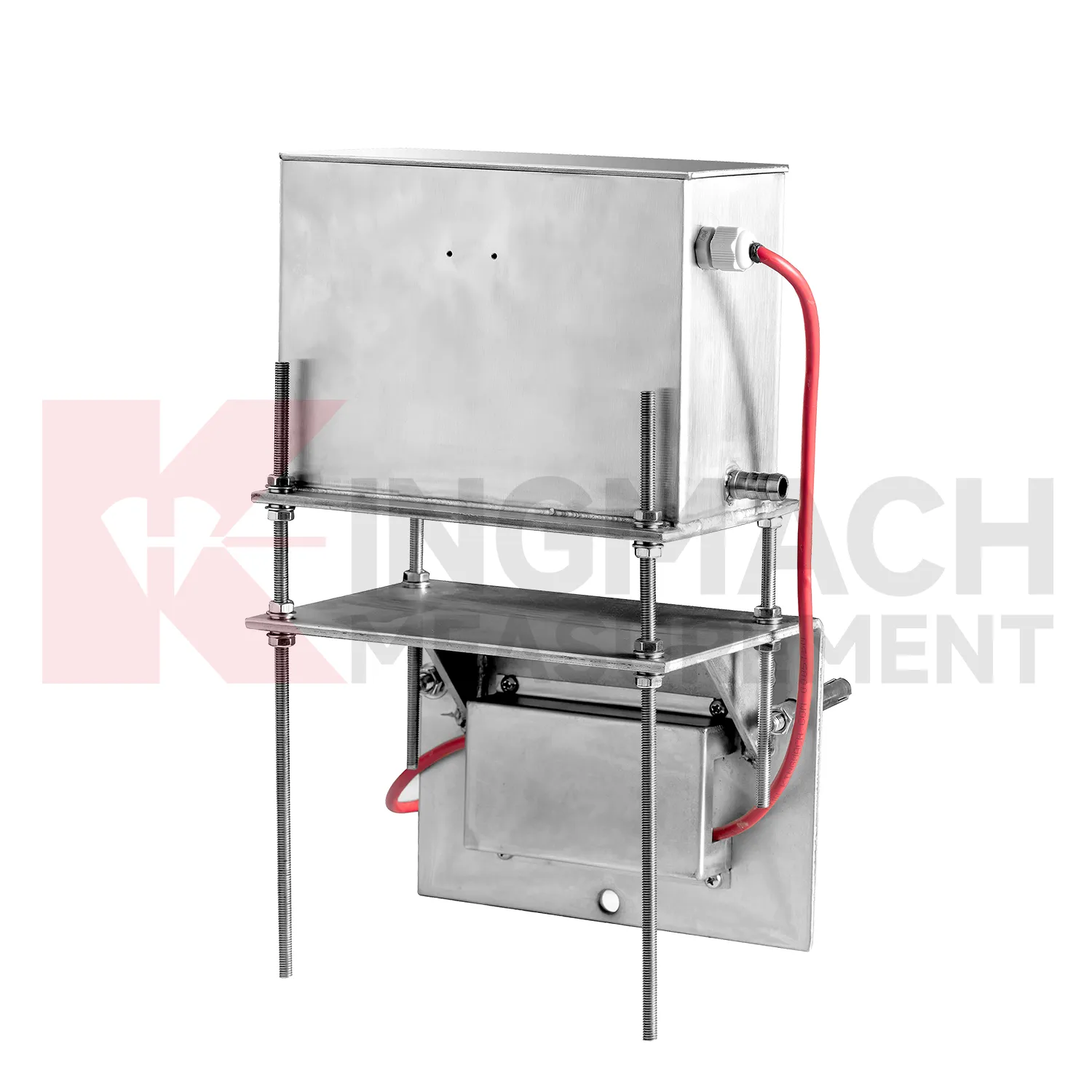
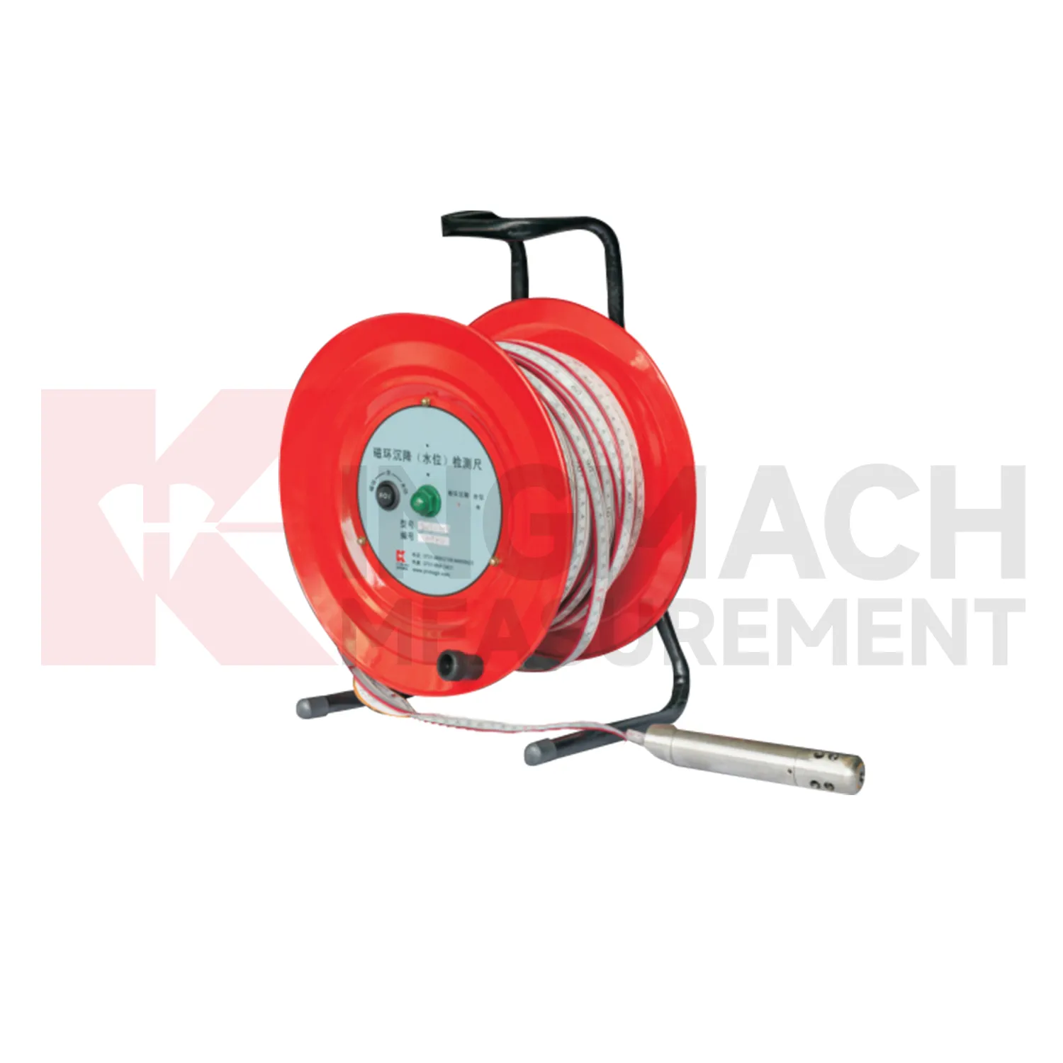
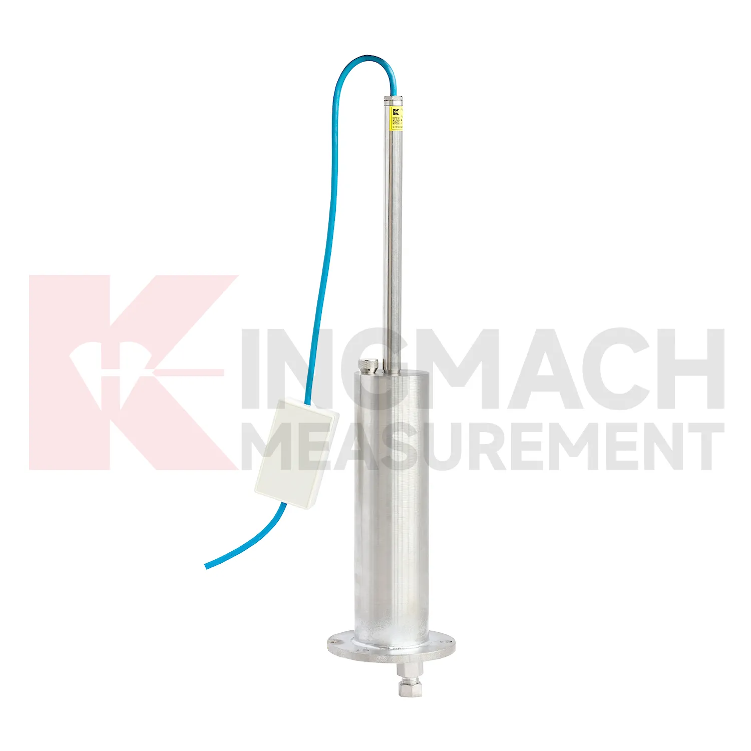
hydrostatic level sensor
The JMCJ-1003/1005 magnetic ring settlement water level gauge gives Kingmach hydrostatic level sensor a manual borehole method for layered ground. It measures underground settlement by electromagnetic induction between the probe and magnetic rings, and it measures water level by conductivity when the probe contacts groundwater. The instrument uses a probe, reel, tape, battery, audible or visual indication, and magnetic rings placed at known depths. Published depth options include 30 m, 50 m, and 100 m, with plus or minus 1 mm accuracy, 9V battery power, maximum current of 50 mA, a probe about 17 cm long and 3 cm in diameter, and -20 degrees Celsius to 60 degrees Celsius operating environment. This product is useful where the engineer needs to know which soil layer compressed, not just how much the surface moved. A careful log should keep borehole number, ring depth, water depth, reference mark, operator, weather, and construction activity together for each visit.
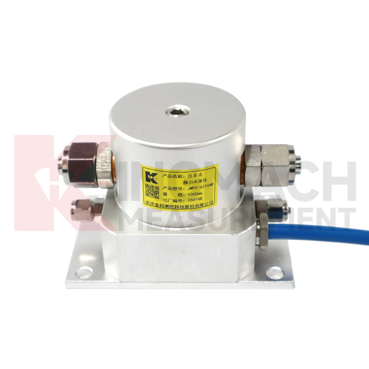
Application of hydrostatic level sensor
In dam monitoring, hydrostatic level sensor are used for long-term observation of dam body settlement, gallery deformation, foundation movement, and vertical change near water-control structures. This work has a slow rhythm: reservoir level, seepage, rainfall, seasonal temperature, and consolidation history may all affect the curve. Kingmach JMQJ-62XXADT gives micro range hydrostatic measurement with IP68 protection and 0.01 mm resolution, while JMYC-62XXAD provides wider 500 mm to 4000 mm ranges for larger vertical displacement. JMDL-62XXADT can form a multi-point hydrostatic leveling network when several positions must be compared from one reference. A dam layout should treat the reference location, tube route, cabinet position, cable protection, and access path as part of the measurement system. During operation, engineers should review settlement data with reservoir records, seepage flow, piezometer behavior, inspection notes from galleries, and downstream observation results. The goal is to see whether a slow trend matches expected consolidation or whether it appears near a structural joint, foundation zone, or water level event. Good records make annual dam-safety review more traceable and reduce confusion when readings are checked years later.
The future of hydrostatic level sensor
Future hydrostatic level sensor will make long-term maintenance analytics more practical. Settlement records are often slow, which means the useful signal may appear over months instead of days. Platforms can compare cumulative settlement, daily rate, seasonal pattern, rainfall, groundwater, traffic loading, filling stage, and excavation history. Kingmach products such as JMYC-62XXAD and JMDL-47XXAT can support this longer view when the baseline and reference point remain stable. Owners will benefit from reports that separate normal consolidation from renewed deformation after new construction, water-level change, or heavy traffic. This is especially important for roadbeds, bridges, buildings, dykes, dams, and reclamation foundations where movement may continue after handover. Future reports should show rate changes, dormant periods, and renewed activity in a way maintenance teams can compare across many assets.
Care & Maintenance of hydrostatic level sensor
Manual-reading hydrostatic level sensor should follow a repeatable procedure every visit. Use the same reference mark, reading direction, tape handling method, waiting time, and data sheet format. This is especially important for magnetic ring settlement gauges and borehole water level readings, where inconsistent field practice can create false changes. Record operator, weather, groundwater condition, borehole obstruction, battery condition, and any unusual sound or visual indication from the alert system. Do not round readings differently from one visit to the next. If manual data is later entered into software, keep the original field notes available for checking. Manual monitoring can be reliable over many years when the process is simple, dated, and boringly consistent. The goal is repeatability, not speed.
Kingmach hydrostatic level sensor
hydrostatic level sensor become most useful when they are part of a disciplined data chain. The sensor body is only one part of the record. Reference point, water tube route, cable label, borehole number, ring depth, bus address, platform unit, baseline, and inspection note all shape whether the final curve can be trusted. Kingmach products support both manual reading and automated acquisition, so the same project may combine field tape readings, RS485 data, bus modules, and software reports. During commissioning, each channel should be checked against the physical point. During maintenance, data gaps should be compared with power, communication, weather, and cabinet work. This makes settlement monitoring less mysterious and more useful to the people who must act on it. When those details are settled before installation, the sensor has a much better chance of producing a reliable curve throughout the project life. When those details are settled before installation, the sensor has a much better chance of producing a reliable curve throughout the project life.
FAQ
Q: Which hydrostatic level sensor fit hydrostatic leveling?
A: JMDL-62XXADT, JMQJ-62XXADT, and JMYC-62XXAD are used for hydrostatic or differential pressure settlement monitoring.
Q: What resolution is available?
A: JMDL-62XXADT and JMQJ-62XXADT list 0.01 mm resolution, while JMYC-62XXAD lists 0.1 mm resolution for wider ranges.
Q: Where are micro range hydrostatic sensors used?
A: They are used for dam settlement, bridge deflection, slope stability, building settlement, tunnel settlement, and subgrade settlement.
Q: What protection rating is listed for JMQJ-62XXADT?
A: The product information lists IP68 protection.
Q: What can damage hydrostatic readings?
A: Leaking tubes, air pockets, poor reference control, temperature effects, cable faults, and disturbed sensor elevations can all affect the record.
Reviews
James Thompson
The tiltmeters and accelerometers are very sensitive and provide precise data. Perfect for our structural health monitoring system.
Robert Taylor
The weir flow meter is well-built and delivers accurate measurements. Great value for water management applications.
Latest Inquiries
To protect the privacy of our buyers, only public service email domains like Gmail, Yahoo, and MSN will be displayed. Additionally, only a limited portion of the inquiry content will be shown.
Ava***@gmail.comAustralia
Hi, I am looking for reliable tiltmeters and accelerometers for structural health monitoring. Please...
Evelyn***@gmail.comSouth Africa
Hi, we are a contractor working on tunnel construction and need settlement sensors and displacement ...